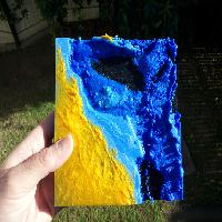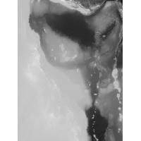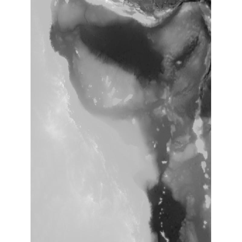

This print was contracted by the Australian Institute of Marine Science. It's a map of Queensland, Australia. The map was created using the bathymetry data from DeepReef.
Map to scale:
Horizontal = From West to East, the map is approximately 1900km.
Vertical = From the deepest ocean to the tallest mountain, this map is only 8km tall.
Greyscale image scale:
Black = -6000m
White = 2000m
The coastline is exactly at 2/3 of the total height.
Source:
Bathymetry: http://eatlas.org.au/data/uuid/200aba6b-6fb6-443e-b84b-86b0bbdb53ac
Blender: https://www.blender.org/
Printer Brand:
Prusa
Printer:
Prusa Mk2
Rafts:
No
Supports:
No
Resolution:
0.1mm
Infill:
20%
Notes:
This print is quite large (155mm x 156mm). I recommend cranking up the bed temperature and using brim for printing, to avoid warping.
Be ready to wait for a very long time! This print took 31 hours 24 minutes to complete on my 3D printer.
If you want to do a multi-colours print like mine, try to calculate a proper Z scale / layer height which will put the 0 (coastline) between 2 layers. The settings I used for my print:
Z scale: 87.64940239
Z height of the first blue layer: 6.7mm
Z height of the first sky blue layer: 16.6mm
Z height of the first orange layer (coastline): 19.9mm
Please share your results!
I created a greyscale image from the Bathymetry, using GeoServer. This step can also be done using QGis or ArcMap.
I created a STL file from the greyscale image using the png23d library.
I engrave the client logos under the map using Blender.
Note: Blender is a free CAD program. It's very powerful but it can be hard to use at first. I strongly recommend learning and using Blender for your 3D projects since it produce error free STL files, ready for 3D printing.